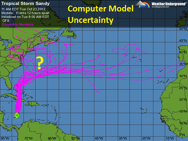
Sunday evening Sandy will begin to turn back to the north, then north west again about 200 miles east of Cape Hatteras. During this time, as Sandy turns more westerly towards land it will begin to join forces with a frontal system that will be moving east toward the coast. From Sunday evening through Monday, this frontal system will become stationary, and then begin to literally absorb a vast amount of tropical moisture associated with Sandy in a virtual tug of war between systems.This will form a large swath of very heavy rain covering over the Midatlantic and southern New England.

Because many trees have begun to lose their leaves, storm drains and sewers will become blocked by these fallen leaves. This will lead to urban flash flooding especially in those flood prone areas. As Sandy gets absorbed by this frontal system it will undergo a metamorphosis, losing its tropical characteristics and becoming more of a larger hybrid type of storm, something like a super Nor'Easter with tropical storm forced winds extending out an extraordinary 400 to 500 miles in diameter with embedded hurricane forced wind gusts.

This hybrid storm is expected to make landfall somewhere over in the Midatlantic between the Delmarva Peninsula and the Jersey Shore on Monday with sustained winds up and over 70 miles per hour. This will have dire repercussions for coastal communities from: The Chesapeake Bay, to the Jersey Shore, to Long Island, to Cape Cod as the ingredients for major coastal inundations are becoming apparent.

These ingredients include: prolonged easterly winds up to tropical storm force, storm surge associated with Sandy, higher than normal tides expected during Monday's full moon, as well as heavy rain; the combination of these factors could potentially, at worst, rearrange coast lines carving out new inlets and new barrier islands. This storm will also have a wintery side as cold air gets dragged into the rear flank of the storm. This could produce a heavy wet snowfall over the higher elevations of the Appalachians in the Virginas and extreme eastern North Carolina. Wide spread power outages that will last for several days can be expected for millions of residents from North Carolina to Long Island due to the nature of this storm.

This storm could wind up totaling up and over $1 Billion in damages when its all said and done, having both a big economic and human toll. Like Hurricane Irene last year evacuation orders will likely be in effect for low lying zones of New York City making this the second time in history the city has issued evacuation orders due to weather. This storm will be nothing to sneeze at as tidal flooding could surpass what was experienced with Irene last year and Hurricane Floyd in 1999.