
 |
| (Click Image to Expand) |
Thursday, March 21, 2013
Wednesday, March 13, 2013

Thursday, March 7, 2013
Tuesday, March 5, 2013

Monday, March 4, 2013
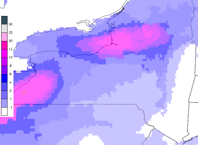
Potential Nor'Easter for the NYC Metro Area this week 3/6 to 3/7
The National Weather Service in Upton, NY has posted a Winter Storm Outlook for the New York City Metropolitan area for the possibility of a coastal storm that could impact the region this week around Wednesday evening into the early hours of Thursday morning. A storm system currently impacting portions of the upper Midwest is expected to move east towards the Midatlantic this week producing significant snows for a wide area along its path. This storm is forecast to strengthen off the south Jersey and Delmarva coast and produce a period of heavy rain that will be transitioning to a heavy wet snow along the Midatlantic including the Baltimore Washington and northern Virginia area on Wednesday. From this point, the track in which this storm takes will determine what impacts, if any, it will have on the New York City Metro area. If this system continues due east, impacts from this storm will be focused well south of NYC Metro. However, if this system takes more of a northeasterly track, there is the potential for significant snow accumulations as well as strong gusty winds and moderate coastal flooding for northern New Jersey, New York City, Long Island and extreme southern New England. At this time, forecast confidence for a big snow event over the NYC Metro is low, but any changes in the projected storm track can significantly change the forecast. Stay tuned!
Subscribe to:
Posts (Atom)


